[
Homepage ] [
Introduction ] [ Warning
] [ Ratings ] [
Ethics ] [ Feedback ] [
Updates ]
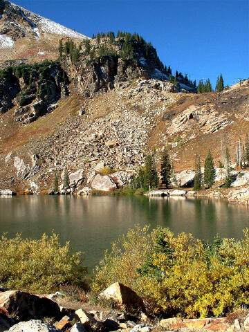 |
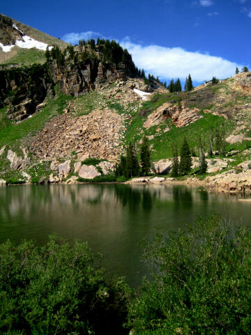
Secret
Lake
aka: Cecret Lake, Albion Basin
Little Cottonwood Canyon
Wasatch Mountains
Mountain
Hiking
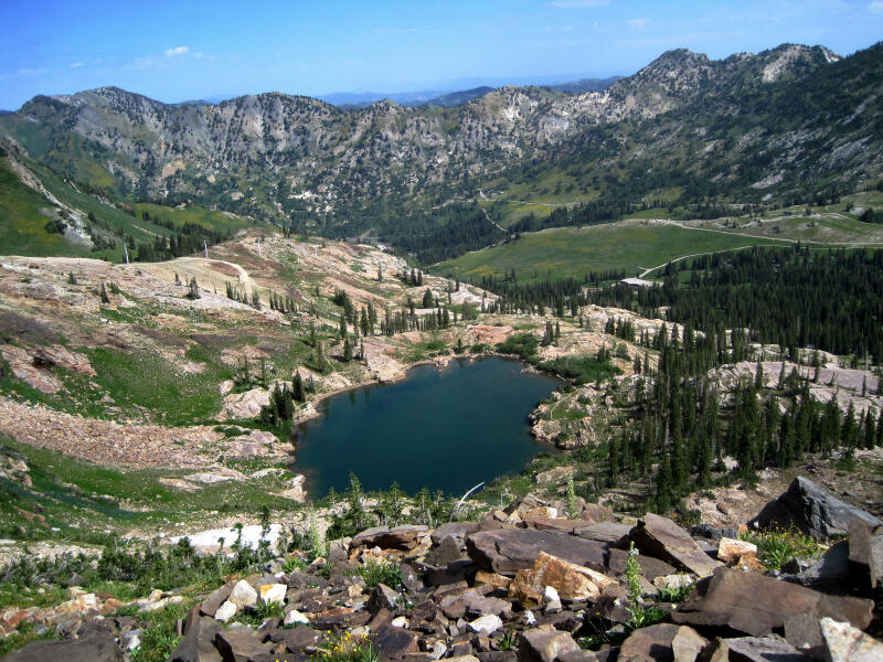
Secret
Lake is a beautiful lake located among alpine meadows in Little Cottonwood Canyons Albion
Basin. Some folks spell Secret Lake as Cecret Lake,
but the USGS maps list it as Secret Lake so I will stick with that. This is a hike that
everyone can certainly enjoy since the route contains little difficulty and is very short. |
  General Information: General Information:
The
hike to Secret Lake is 1 mile and will take the average hiker about 30 minutes to
reach. The hike is relatively flat and is more of a stroll than a hike. This trail is
suitable for small children and seniors. Weather can change quickly and afternoon
thunderstorms are not uncommon. No swimming is permitted in the lake. The lake is usually
accessible from mid summer until the first serious snow fall. About mid August
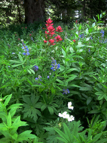
Albion Basin explodes with the color of radiant wild flowers. Around the
first week
of October the autumn leaves change color and provide a new color setting.
There is
nothing difficult about this hike. Navigation for this route is easy, but for those who
just have to carry a map "Brighton" is the USGS 7.5 minute topographical map
which shows Secret Lake.
Stronger hikers might also want to visit the summit of Sugarloaf Peak. This will add an
extra two hours round trip to your hiking time. Since 11,051' Sugarloaf Peak is the 13th
highest peak in Salt Lake City this is a good time to tick the summit off your peak
baggers list. The short trip to the summit of Sugarloaf offers no difficulties.
Excellent
camping is available at the Albion Basin Campground which is located at the trailhead.
There is a campground host on site. Restrooms and drinking water are provided. Both
reserved and first come first served sites are available. Reserve America handles on-line site
reservations.
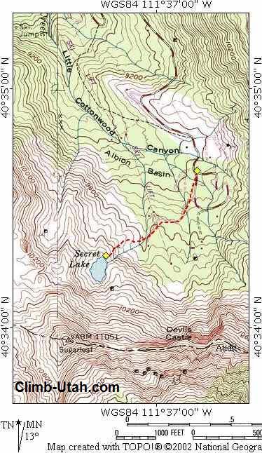
Trailhead Information:
From I-15 in Sandy, Utah
take Exit #298 (9000 South) and head east on Highway 209 (9000 South) for 6.9 miles at
which point Highway 209 joins Highway 210 (Little Cottonwood Canyon Road) at a Y-Junction.
All mileage in this canyon is measured from this Y-Junction. The junction is identified be
a huge flashing message board on the south side of the road and a park and ride lot on the
north side of the canyon. The park and ride lot has a restroom.
From the Y-Junction at the mouth of Little Cottonwood Canyon drive up canyon 11.1 miles to
a parking lot on the left side of the road just before the entrance to Albion Basin
Campground. The road up Little Cottonwood Canyon is paved as far as the Alta Ski
Resort but the last 2.4 miles of the road is a well maintained gravel road.
Route Information:
The trail
begins at the entrance to the Albion Basin Campground (N40° 34' 40", W111° 36' 47"). Your destination
is Secret Lake, the trail is supposed to be signed but sometimes signage is
lacking.
From
the Albion Basin Campground entrance the trail hikes around the west side of the
campground and interests an access road. Follow the access road west. After a short
distance the access road will fork with the right fork leading to a cabin and the left
fork leading to Secret Lake. Take the left fork and continue to Secret Lake. The
road you are following shortly turns into a wide trail as it climbs past an old mine to
Secret Lake. The area is criss-crossed with minor trails, just keep following the most
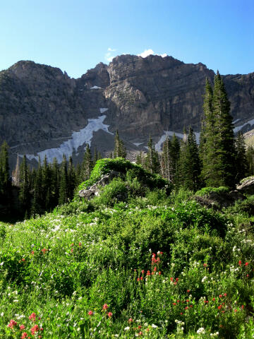
well used trail west and you will reach Secret Lake (N40° 34' 18", W111° 37' 17"). Enjoy the view
of the North Face of Devils Castle as you hike to the lake.
The view of Devils Castle is very impressive.
Since the trail to Secret Lake is more of a stroll than a hike many will arrive at the
lake with energy to burn. May I suggest hiking to the summit of 11,051'
Sugarloaf Peak for those who want a little more exercise without to much difficulty.
Those who like a real challenge can try to complete the Devils
Castle Traverse. Sugarloaf Peak is the 13th highest peak in Salt Lake
City and this is a good time to tick the summit off your peak baggers list. This is also
one of the easier high summits to reach.
Albion Basin Shuttle:
Parking in the upper canyon is limited and often difficult to find. If you
want to be assured of a parking place on a weekend it is best to arrive
early (before 9:00 a.m.).
You can make life much easier and
avoid the parking issues by taking the free Alta
Shuttle. The information booth at the end of the paved road can answer any
of your shuttle questions. If you see a sign stating "Parking Lots Full in
Albion Basin" save yourself the headache and just hop on the next shuttle.
Riding the shuttle up and hiking back to your vehicle is a very popular
option.
The Town of Alta sponsors
the free shuttle service to help reduce automobile traffic into Albion
Basin. The shuttle transports visitors from the end of the paved Little
Cottonwood Canyon road (UT 210), in the Town of Alta, for 2.5 miles to the
upper end of Albion Basin road. Shuttle service begins mid-July and operates
on weekends (Saturday and Sunday), and holidays (July 24th, Labor Day). The
service extends into September if required.
The shuttle consists of
two or three 14-passenger vans that operate between 9:00 a.m. through 4:30 p.m.
The typical wait time between shuttles is 10 to 20 minutes. While the shuttle is not mandatory, visitors are
encouraged to park their car and utilize this service to reduce resource
impacts along the gravel road. Albion Basin road will remain open for
visitors choosing not to use the shuttle. The shuttle has three pick-up and
drop-off points: just west of the summer information booth, Sunnyside
Parking Area/Catherine’s Pass trailhead, and Secret Lake trailhead at Albion
Basin campground. The last van will depart from the Secret Lake trailhead at
the upper end of the road at 4:30 p.m.
Video:
Here is a short video taken the second weekend of August when the wild
flowers were at their finest. If this video fails to play on your mobile
device or computer you can always watch the
Original YouTube Version here.
[
Homepage ] [
Introduction ] [ Warning
] [ Ratings ] [
Ethics ] [ Feedback ] [
Updates ]
© Copyright
2000-2025, Climb-Utah.com |